 The Garden
 Digital Twins of Earth: Testing Governance Before the Crisis Arrives
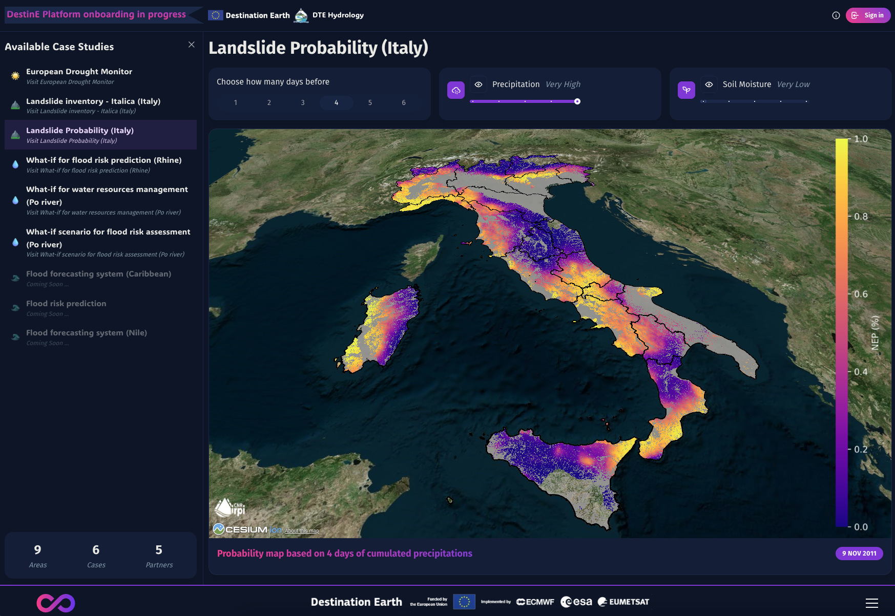
ESA's Digital Twin Earth program creates real-time planetary simulations — not just to model floods or fire, but to stress-test governance responses before disaster strikes. It's scenario planning made operational, fed by satellite data and constrained by physics.
Why this matters →
How do you see this story?